

El Niño 2026-27: Key Facts
- What’s happening: El Niño has returned to the tropical Pacific and is strengthening fast — NOAA now puts the odds of a very strong event this winter at greater than 90%.
- Historic potential: There’s roughly a 75% chance this becomes a historically strong El Niño (stronger than any since 1950) during October–December 2026.
- Peak window: Forecasters expect peak intensity between October and December 2026, with effects persisting into early 2027.
- U.S. winter lean: Warmer-than-normal conditions favored across much of the northern U.S.; wetter-than-normal conditions favored across California, the southern U.S., and parts of the East Coast.
- Why it matters for you: Winter storm timing, holiday travel, heating bills, and outdoor events from Thanksgiving through Christmas could all feel the effects.
If the winter of 1997–98 or 2015–16 felt like weather on steroids, get ready: the Pacific is setting up for an encore — possibly a record-breaking one. El Niño 2026 has returned, and the numbers behind it are startling enough that federal forecasters are using words like “historic” in official outlooks. In its September 10, 2026 ENSO Diagnostic Discussion, NOAA’s Climate Prediction Center estimated a greater than 90% chance that El Niño reaches very strong intensity during the fall and winter of 2026–27 — and roughly a 75% chance it becomes a historically strong event, exceeding every El Niño on record since 1950.
This isn’t just a science story. El Niño reshapes storm tracks, rainfall, temperatures, and even the odds of an active hurricane season across the United States. With Thanksgiving, Christmas, and the entire winter events season ahead, understanding what El Niño 2026 means for your plans — travel, outdoor celebrations, heating costs, and storm safety — is genuinely practical. This guide breaks down the forecast, the regional impacts, and how to prepare.
What Is El Niño?
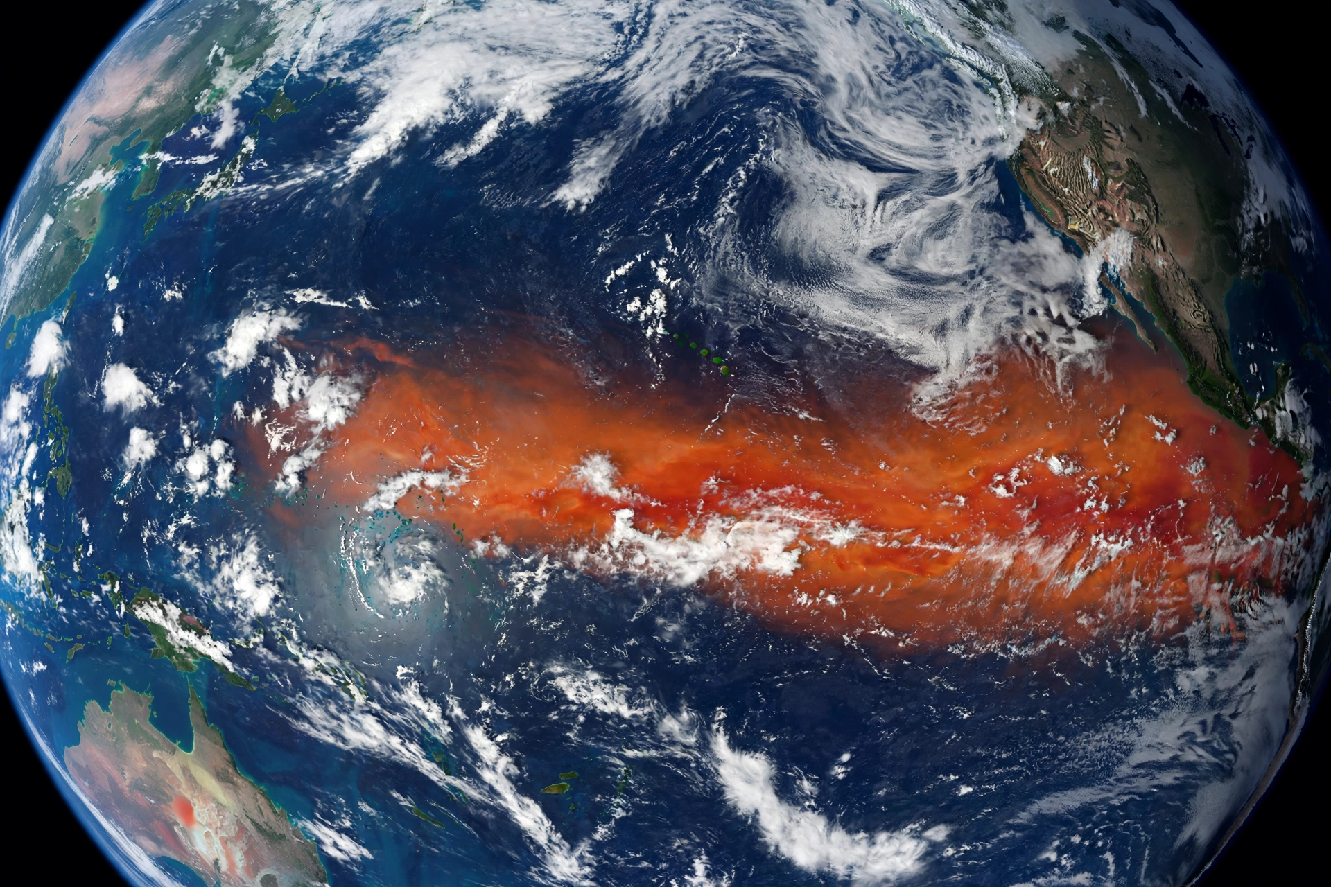
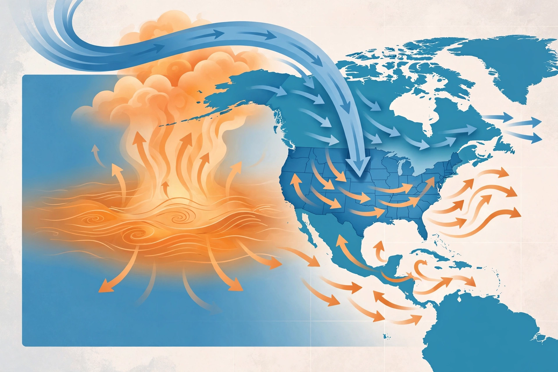
El Niño is a recurring climate pattern in which sea-surface temperatures in the central and eastern tropical Pacific Ocean run unusually warm, coupled with changes in the atmosphere above. Those warm waters shift where tropical thunderstorms form, which in turn bends the jet streams that steer weather around the world — including across North America.
El Niño and its cool-water counterpart La Niña cycle every few years (collectively called ENSO — the El Niño–Southern Oscillation). During strong El Niño winters, the Pacific jet stream typically shifts southward and strengthens, aiming storms more directly at the southern United States while leaving the northern U.S. and Canada warmer and drier than average. But no two El Niño events behave identically: strength tilts the odds, it doesn’t dictate local outcomes.
How scientists measure El Niño strength
NOAA tracks several indices. The one most often quoted is the temperature anomaly in the Niño-3.4 region of the central Pacific. NOAA’s “very strong” category is tied to the Relative Oceanic Niño Index (RONI), with a threshold of about +2°C above average for a three-month period. When forecasters talk about this event potentially exceeding every El Niño since 1950, they mean the RONI could climb above levels seen even in the notorious 1997–98 and 2015–16 events.
El Niño 2026: The Forecast Timeline
Here’s how the outlook sharpened through the summer and early fall of 2026:
- June 2026: NOAA gave the November–January period only a 63% chance of reaching very strong status — already elevated, but uncertain.
- July 2026: Odds rose to 81% as Pacific warmth built. Colorado State University was already revising its Atlantic hurricane forecast downward, partly because El Niño’s wind patterns suppress hurricane formation.
- August 2026: Sea-surface temperatures in the eastern equatorial Pacific blew past 3°C above average, and NOAA confirmed El Niño was strengthening. The World Meteorological Organization’s August update projected nearly 100% probability the event persists through February 2027.
- September 8, 2026: NOAA diagnostics confirmed the strengthening trend, estimating a greater than 90% chance of a very strong event between September 2026 and January 2027.
- September 10, 2026: The headline ENSO Diagnostic Discussion raised the odds to more than 90% for a very strong event this fall/winter and ~75% for historically strong strength in the October–December window (RONI of at least 2.5°C — above all events since 1950). A 98% probability of a very strong event was attached to the October–December period itself.
The measured temperatures help explain the urgency: in August, NOAA reported anomalies of about +1.8°C in Niño-3.4, +2.5°C in Niño-3, and +3.4°C in the Niño-1+2 region near South America. Subsurface heat at some depths exceeded normal values by more than 8°C — an enormous reservoir of stored energy that can keep feeding the event for months.
Why El Niño 2026 Is Trending Now
El Niño surged on Google Trends U.S. on September 22, 2026, because the September 10 NOAA outlook landed with unusual force. When forecasters assign a three-in-four chance of the strongest El Niño ever measured, it stops being background climate noise and starts being a winter-planning variable. Media coverage highlighting comparisons to the damaging 1997–98 winter amplified the spike in interest.
The timing matters too: autumn is when Americans plan holiday travel, book ski trips, and watch heating-oil and electricity prices. With peak intensity expected between October and December — right across Thanksgiving and Christmas — the practical questions are immediate, not academic.
El Niño 2026 Winter Outlook for the United States
Seasonal outlooks describe probabilities over months, not individual storms. But the broad pattern NOAA favors for winter 2026–27 is clear:
Temperature
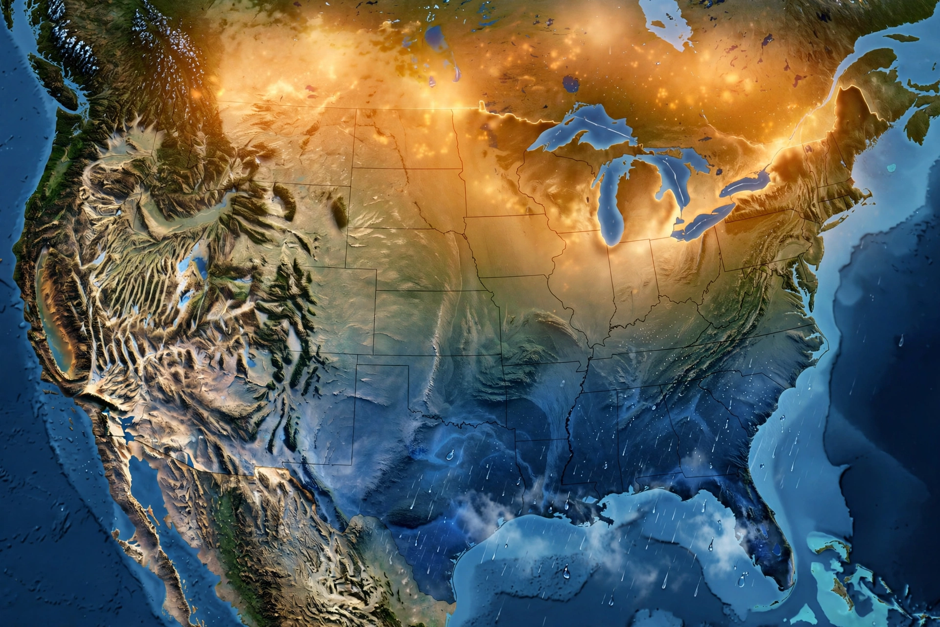
Warmer-than-normal conditions are favored across much of the western and central United States, with elevated probabilities of above-normal temperatures across other northern regions as well. The Old Farmer’s Almanac’s winter forecast, which treats the developing El Niño as a primary driver, likewise leans toward a milder winter across much of the country — though it notes cold and snowy periods remain possible, with relatively few areas projected colder than normal.
Precipitation
Wetter-than-normal conditions are favored across parts of the East Coast, California, and the southern U.S. During strong El Niño events, the southern jet stream can deliver a parade of Pacific storms to California and the Gulf states, while the Pacific Northwest often turns drier. For skiers and riders in the southern Rockies and California mountains, that can mean a bumper season; higher-elevation terrain tends to benefit most, since warmer air can push the snow line higher at valley levels.
Storm tracks
A strengthened, south-shifted Pacific jet typically means more frequent winter storms across the southern tier of the U.S. and fewer, less intense intrusions of Arctic air into the northern plains and Midwest. But strong El Niño winters have also delivered memorable exceptions — the point is shifting odds, not certainties.
What El Niño Means for Holiday Travel and Events
Winter is the busiest events season in America — Thanksgiving reunions, Christmas travel, New Year’s celebrations, outdoor light displays, parades, and ski vacations. Here’s how a strong El Niño could intersect with those plans:
- Thanksgiving travel (late November): Expect the peak El Niño window. Southern travelers could face rain-heavy storm systems; northern travelers may see milder but still unpredictable conditions. Book refundable fares and build buffer days into tight itineraries.
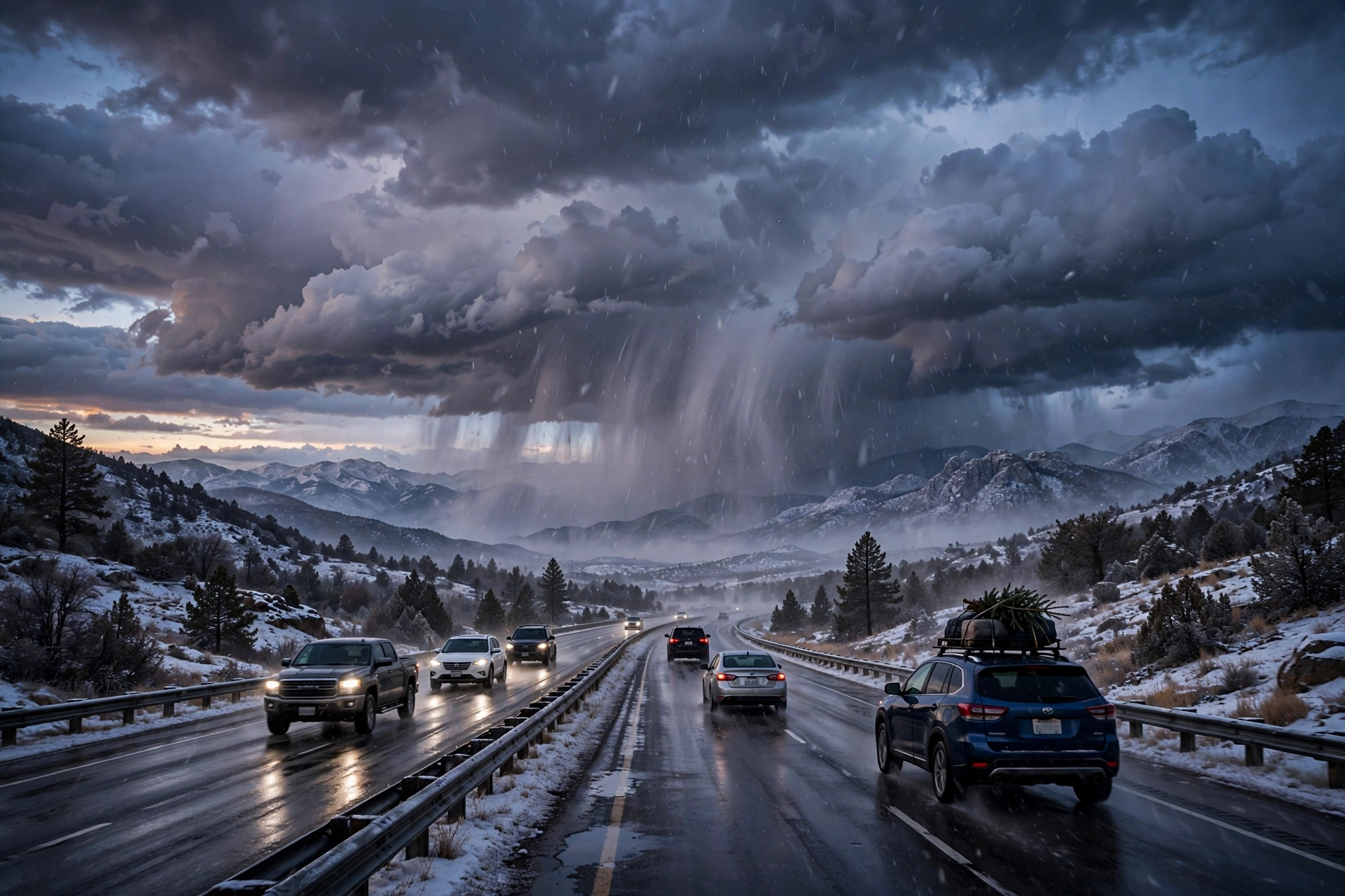
- Christmas and New Year: California and the South often see the stormiest El Niño weather by December. If you’re heading to Florida, Texas, or the Southeast, pack for rain rather than cold — and double-check outdoor event plans. Mountain ski trips in Colorado, Utah, and California could be excellent, especially at higher elevations.
- Outdoor events and decorations: Wind-driven storms can knock out lights and decorations. In the southern U.S., plan for wetter conditions at holiday parades, light shows, and markets. In the north, a milder start to winter doesn’t rule out sudden cold snaps.
- Heating costs: A milder northern winter can ease heating demand — but energy analysts have already noted elevated electricity prices in some regions, including California, where residential rates have been reported running well above the national average. Watch utility rates alongside the thermostat.
- Hurricane season afterglow: One silver lining — El Niño’s wind shear has already suppressed Atlantic hurricane activity this season, which is part of why this fall’s storm calendar stayed relatively quiet compared with recent years.
How to Prepare for an El Niño Winter
Preparation is the same whether this event becomes the strongest on record or “merely” a very strong one:
- Follow seasonal outlooks, not hype: NOAA’s Climate Prediction Center issues updated seasonal outlooks monthly. Check the official outlook before booking big-ticket winter trips.
- Storm-proof your home: Clean gutters, trim weak branches, and check drainage — wetter-than-normal winters in California and the South turn clogged drains into indoor waterfalls.
- Pack flexibly for travel: Layers, waterproof shells, and backup plans beat trying to out-guess a three-month outlook.
- Watch for flooding in California: Strong El Niño winters have historically brought heavy rain and mudslides to Southern California, especially in burn-scar areas. Keep an emergency kit and know your evacuation routes.
- Budget for energy swings: Volatile commodity and electricity prices have already accompanied this event’s buildup; set alerts for utility rate changes.

El Niño 2026 vs. Past Record Events
The two most common historical comparisons are 1997–98 and 2015–16:
| Event | Peak strength | Notable U.S. impacts |
|---|---|---|
| 1997–98 | One of the two prior events reaching comparable ocean anomalies | Severe California storms and flooding, ice storms in the Northeast, billions in damage |
| 2015–16 | Most recent event at a similar strength level | Wet South, warm North; notable California storminess |
| 2026–27 (forecast) | Tracking at or above the “very strong” threshold; ~75% chance of exceeding all events since 1950 | Peak October–December 2026; impacts still to unfold |
Super El Niños tend to occur roughly once every 10 to 15 years, but historical analogues are reference points, not guarantees — no two events unfold exactly the same way. Forecasters emphasize that strength shifts the odds of regional impacts; local weather agencies and seasonal outlooks remain essential for assessing specific risks.
Frequently Asked Questions
Is El Niño 2026 the strongest ever?
Not yet — but it’s on track. NOAA gives the October–December 2026 period roughly a 75% chance of becoming a historically strong event, exceeding every El Niño on record since 1950. That’s a forecast probability, not a completed record. The peak is expected between October and December, so the answer will be clearer by early 2027.
Will El Niño 2026 bring more snow to the Northeast?
Possibly, but it’s far from guaranteed. NOAA favors wetter-than-normal conditions across parts of the East Coast and warmer-than-normal conditions across much of the northern U.S. The ingredients for an active winter are there, but whether that translates to a snowy season in places like Pennsylvania depends on storm-track timing and how often cold air dips south. Forecasters caution that a milder winter overall doesn’t rule out individual big snowstorms.
What does El Niño mean for California?
Strong El Niño winters typically bring wetter-than-normal conditions to California, including Southern California, where heavy rain and mudslide risks rise. Higher-elevation ski areas often benefit from bigger storm totals, though warmer air can raise the snow line at valley levels. If you live in a burn-scar area, review evacuation plans before the rainy season.
Will El Niño affect Thanksgiving and Christmas travel?
Likely, around the margins. The forecast peak (October–December) overlaps the entire holiday travel season. Southern routes may see more rain-related delays, while northern routes trend milder but can still be hit by storms. Building buffer time and choosing refundable fares are the smartest hedges.
How long will El Niño 2026 last?
The World Meteorological Organization’s August update projected nearly 100% probability the event persists through February 2027, with NOAA’s diagnostics indicating a greater than 90% chance of very strong intensity between September 2026 and January 2027. Effects on U.S. weather typically linger through the winter months.
Does El Niño affect hurricane season?
Yes — El Niño tends to suppress Atlantic hurricane formation through increased wind shear, and that pattern has already played out this season: forecasters revised already-low hurricane outlooks downward. Note that the related tropical storms tracked on this site, like Hurricane Polo and the nor’easter pattern, developed in the Pacific and coastal Northeast respectively, where different dynamics apply.
Where can I check the latest El Niño forecast?
NOAA’s Climate Prediction Center publishes ENSO Diagnostic Discussions roughly monthly — those are the primary source behind every statistic in this article. Seasonal outlooks are updated monthly as well, so revisit them before locking in winter travel plans.
Conclusion
El Niño 2026 isn’t a distant climate curiosity — it’s a strengthening, potentially record-setting event whose peak lands squarely on top of America’s holiday season. The headline numbers tell the story: greater than 90% odds of a very strong event, about 75% odds of the strongest since 1950, and peak intensity forecast between October and December. Expect a winter that tilts milder in the north and wetter in the south, with holiday travel, outdoor events, and energy budgets all worth a second look.
The best response isn’t anxiety — it’s preparation. Follow the monthly NOAA outlooks, keep travel plans flexible, and check your storm readiness before the rainy season. Winter 2026–27 is shaping up to be one for the record books either way.
More from Events Day
Sources: FindArticles — NOAA Sees 75% Chance of Historically Strong El Niño; Karmactive — NOAA El Niño Forecast Raises Historic Winter Odds; Delaware Online — Will El Niño Bring More Snow to Pennsylvania?