


A nor’easter storm is taking shape off the U.S. East Coast this week, and forecasters say it could bring several days of rain, gusty winds, and coastal flooding from the Outer Banks to New England. The National Weather Service said on September 21, 2026, that a coastal low is expected to develop off the Mid-Atlantic coast and strengthen into a nor’easter as it tracks northward late in the week, with the biggest impacts expected Thursday through Saturday. (USA Today, September 21, 2026)
Key Facts: Nor’easter Storm — September 2026
- What: A coastal low developing off the Mid-Atlantic coast, forecast to strengthen into a nor’easter.
- When: Wednesday, September 23 through Saturday, September 26, 2026; steady rain and strongest winds expected Friday into Saturday in Southern New England.
- Where: Eastern North Carolina (Outer Banks), the Mid-Atlantic coast, and Southern New England — with travel impacts along the I-95 corridor from New York to Boston.
- Main threats: Heavy rain, gusty northeasterly winds, dangerous surf, beach erosion, and coastal flooding amplified by full-moon high tides.
- Confidence: Moderate — forecasters agree a storm will form, but the exact track and strength are still uncertain.
What Is a Nor’easter Storm?
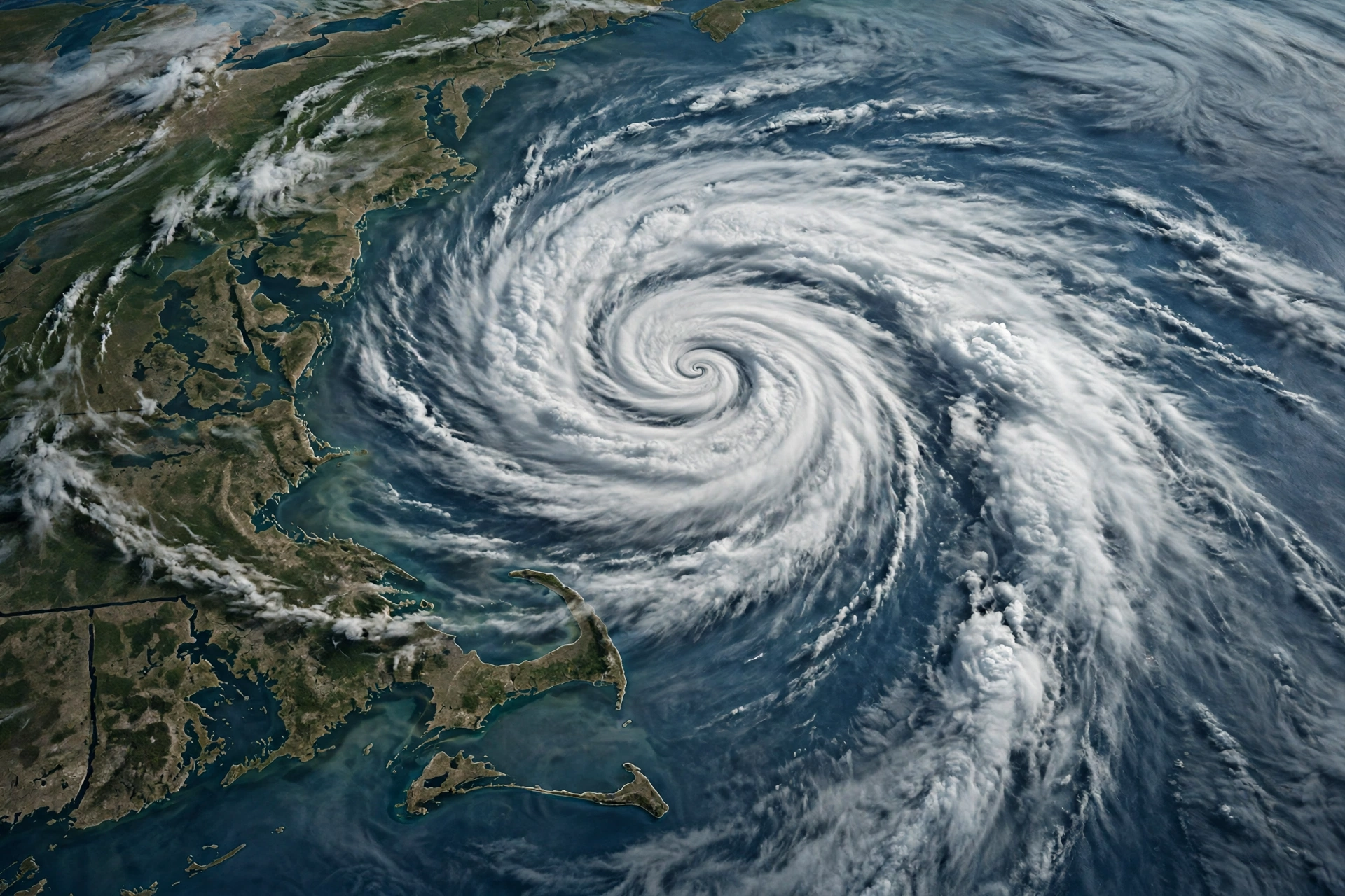
A nor’easter is a large, intense area of low pressure that typically develops off the East Coast during the late fall, winter, and early spring. The storms earned their name because they usually bring strong northeast winds over the East as they move north along the Atlantic Coast. Nor’easters are among the most disruptive storm systems in the northeastern United States — they can deliver heavy precipitation, hurricane-force wind gusts, and battering surf along hundreds of miles of coastline at once.
This September system is unusual for the timing: it is forming in early fall rather than the peak winter season. That means one important difference — no snow. As Rhode Island forecasters noted, unlike the nor’easters seen in the winter months, this one will bring only rain and wind. The ingredients, however, are classic: an offshore low drawing moisture northward while strong high pressure over New England and eastern Canada squeezes the pressure gradient, driving persistent northeasterly winds straight into the coast.
Nor’easter Forecast: Day-by-Day Timeline (September 22–26, 2026)
Forecasters are still refining the track, but the broad timeline is coming into focus. Here is what the National Weather Service and major forecasters expect day by day:
Monday–Tuesday, September 22–23: Quiet Before the Storm
Much of the East will see a mostly dry early week. In Southern New England, any lingering Monday-morning showers end around sunrise as a weak area of low pressure pulls away, giving way to a breezy but pleasant afternoon with highs in the mid-60s. Tuesday and Wednesday also look dry, with highs in the low 60s under partly to mostly cloudy skies. The weather pattern begins to tighten late Tuesday, when winds start picking up — the first sign the setup is locking in.
Wednesday, September 24: The Low Takes Shape
The low-pressure center is expected to develop off the Mid-Atlantic coast on Wednesday. Eastern North Carolina will feel it first: increased rain arrives around September 24, and North Carolina forecasters warn that hazardous marine conditions could emerge starting Wednesday as large waves bring “dangerous surf conditions, beach erosion and potentially ocean overwash at vulnerable locations along the Outer Banks.”
Offshore, marine and coastal impacts along the mid-Atlantic may begin as early as Wednesday even before the storm’s center moves north. The Weather Service’s Wakefield office has included Corolla and Carova Beach in an area of potential moderate coastal flooding Wednesday and Wednesday night, which could persist through multiple high-tide cycles as northeast winds continue. (The Providence Journal, September 21, 2026)
Thursday, September 25: Storm Tracks North
It becomes overcast across Southern New England as the coastal storm spins up south of the region and strengthens while moving northward toward Southern New England on Thursday. Rain reaches New England on September 25, and temperatures will be cooler than usual in the East, particularly across the Mid-Atlantic. Travelers through major hubs like New York and Boston should keep a close eye on the weather — the later half of this week could slow travel along the I-95 corridor.
Friday–Saturday, September 25–26: Peak Impacts
Confidence is increasing in a period of steady rain from Friday into Saturday, accompanied by a gusty northeasterly wind, as the storm likely holds close to the coast through the weekend. This is when the biggest impacts land: heavy rain, strong winds, pounding surf, and the highest risk of coastal flooding — made worse by full-moon high tides that raise water levels. The National Weather Service says multiple days of strong onshore winds could lead to coastal flooding and beach erosion across the region.

Nor’easter Storm Impacts: Rain, Wind, Surf, and Coastal Flooding
Heavy Rain and Wind
Exactly how much rain falls depends on the storm’s track — the classic model disagreement. The GFS model brings the low closer to shore than the European model; if the low hugs the coast, several inches of rain could fall, raising flash-flooding concerns. Forecasters are monitoring the possibility of sustained winds of 20 to 30 mph along the Outer Banks, gusting to 40 to 50 mph, though those speeds remain highly dependent on the offshore low’s track and strength. One AccuWeather forecaster put it plainly: the closer to the coast the storm forms and strengthens into a nor’easter, the greater the risk of heavy rain, strong winds, and pounding surf.
Dangerous Surf and Beach Erosion
The surf is expected to be the storm’s signature hazard. Big swells offshore will likely keep boaters in port from Thursday through the weekend. There could be coastal flooding, especially at east-facing beaches late this week. On the Outer Banks, forecasters expressed high confidence in a prolonged period of dangerous ocean conditions — ocean overwash at vulnerable locations and minor coastal flooding along the southern Pamlico Sound.
Travel Disruptions
Rain and storms could impact travel plans across the East this week, with delays possible in cities like Atlanta, Raleigh, and Richmond early in the week and along the New York-to-Boston corridor later. If you are traveling through major hubs in the region, monitor forecasts closely, as a nor’easter can slow air travel and make driving treacherous. (The Weather Channel, September 21, 2026)

How a Nor’easter Storm Differs From a Hurricane
People often confuse the two, but nor’easters and hurricanes are fundamentally different storms. A hurricane is a tropical cyclone fueled by warm ocean water, with a compact core and the most destructive winds concentrated near the eye. A nor’easter is an extratropical low fueled by temperature contrasts between cold air from the north and warmer air over the Atlantic — it can be far broader, covering several states with a single comma-shaped cloud shield, and it draws its energy from the jet stream rather than tropical heat.
The impacts differ too. Hurricanes tend to be shorter, sharper events; nor’easters often stall and pound the coast for days. Because nor’easters are common in winter, they can produce blizzards — but this September system will be a rain-and-wind event, not a snowstorm.
Nor’easter Storm Preparation: Safety Checklist
With forecast confidence still limited, the smartest move is to prepare now and stay flexible. Forecasters advise thinking about moving outdoor activities indoors on Friday and Saturday. Here is a practical checklist:
- Secure outdoor items: Bring in or tie down patio furniture, grills, trash cans, and anything the wind can turn into a projectile.
- Prepare for power outages: Charge devices, keep flashlights and batteries handy, and know where your utility company’s outage map is.
- Clear drains and gutters: With several inches of rain possible, clogged drainage turns heavy rain into local flooding.
- Avoid the surf: Do not swim, surf, or walk near jetties and rocks during high surf — rip currents and sneaker waves can be deadly.
- Know your flood zone: If you live near the coast, check whether you are in an evacuation or flood-risk zone before the water rises.
- Delay coastal travel: Reconsider beach trips and coastal drives Friday and Saturday; never drive through flooded roads.
- Monitor forecasts: The storm’s track is still uncertain — check the National Weather Service for updates, since the forecast can shift significantly.

Why the Full Moon Matters During This Nor’easter Storm
This storm arrives around the full moon, and that is not a coincidence to ignore. Higher tides mean storm-driven water piles onto an already elevated baseline, which is why the National Weather Service specifically flagged coastal flooding and beach erosion as this system raises the tides. Astronomically high tides plus onshore winds are the classic recipe for overwash at vulnerable beach locations like the Outer Banks and east-facing New England beaches. If you own or rent coastal property, this is the week to move valuables to higher ground.

Conclusion
The nor’easter storm developing off the East Coast this week is a textbook early-fall coastal event: a slow-moving low, days of onshore wind, heavy rain, dangerous surf, and coastal flooding amplified by full-moon tides. The heaviest impacts should land Friday into Saturday from the Outer Banks to Southern New England, with travel disruptions possible along the entire I-95 corridor. Forecast confidence is still low on the exact track — so stay informed, prepare early, and treat this storm with the respect any nor’easter deserves.
Stay safe, and keep checking the National Weather Service for the latest advisories as the week unfolds.
Frequently Asked Questions About the Nor’easter Storm
When will the nor’easter storm hit?
The low is expected to develop off the Mid-Atlantic coast on Wednesday, September 23, 2026, and track north toward Southern New England Thursday and Friday. The steadiest rain and strongest winds should arrive Friday into Saturday, September 25–26, with rain reaching New England on the 25th and 26th.
Will this nor’easter bring snow?
No. Unlike winter nor’easters, this September storm will be a rain-and-wind event only. Temperatures will be cooler than usual, with highs in the 60s in Southern New England, but well above freezing.
Which areas are most at risk?
Eastern North Carolina’s Outer Banks (dangerous surf, overwash, wind gusts to 40–50 mph), the Mid-Atlantic coast, and Southern New England (steady rain, gusty winds, coastal flooding at east-facing beaches). Travel along the I-95 corridor from New York to Boston may also be affected.
What causes a nor’easter?
A nor’easter is a large, intense low-pressure system that develops off the East Coast and moves north along the Atlantic, drawing strong northeasterly winds over the region. They form when cold northern air clashes with warmer air over the Atlantic, and they get their energy from the jet stream and temperature contrasts rather than warm tropical water like hurricanes.
Is the forecast certain?
No — forecasters emphasize low-to-moderate confidence. They agree a coastal storm will form and likely become a nor’easter, but “considerable spread remains in the exact track and strength of the low,” per the National Weather Service. Impacts could range from a glancing blow to several inches of rain with significant coastal flooding.
How can I stay safe during the nor’easter?
Secure outdoor items, prepare for possible power outages, avoid the surf and flooded roads, clear drains and gutters, move outdoor plans indoors Friday and Saturday, and monitor National Weather Service updates as the forecast evolves.
More from Events Day
- Beach Hazards Statement: Sneaker Waves, Rip Currents & Coastal Safety Guide — another coastal-weather guide on staying safe at the shore.
- Zion National Park Guide — plan a trip when the storm passes.